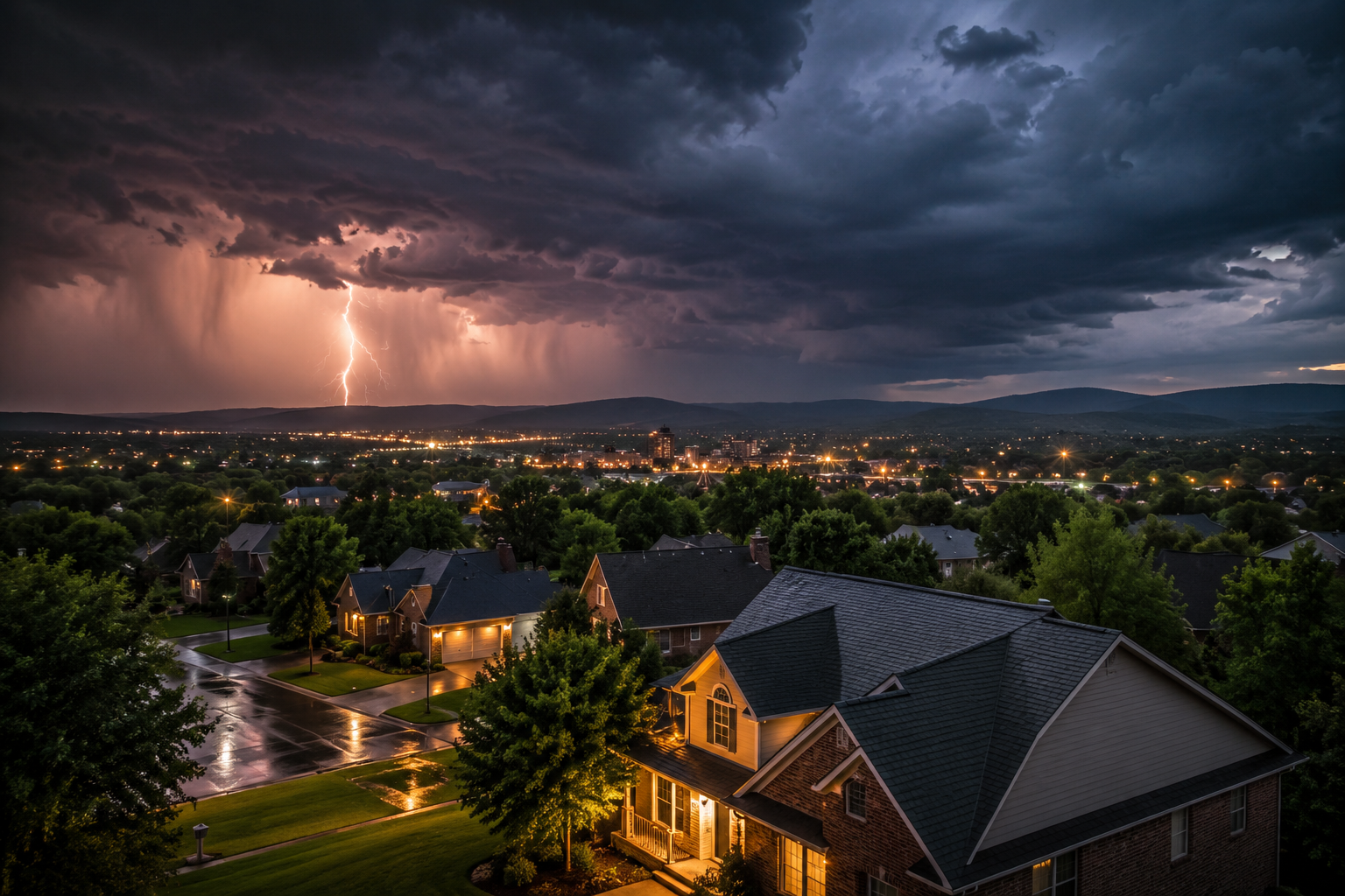
North Alabama
Storm Center
Hail, wind, missing shingles, emergency leaks, and insurance documentation support from a local roofing team built for North Alabama storm season.
Fast Response
Built for severe weather calls
Damage Photos
Inspection documentation support
Licensed & Insured
Local team you can trust
Claim Support
Help with storm event details
What Do You Need After The Storm?
Hail Damage
Dents, bruised shingles, granule loss, and hidden impact damage.
Wind Damage
Lifted shingles, missing tabs, exposed underlayment, and roof-edge damage.
Emergency Leaks
Active leaks, temporary stabilization, and fast storm response support.
Insurance Help
Inspection documentation and storm-date support for your claim process.
Need The Storm Date For Your Claim?
Review recent storm activity across North Alabama. The latest tracked event is * WHAT...Flooding caused by excessive rainfall is possible. * WHERE...Portions of southeast Alabama, the Florida Panhandle and Big Bend, and southwest Georgia. * WHEN...From Friday afternoon through Saturday evening. * IMPACTS...Excessive runoff may result in flooding of rivers, creeks, streams, and other low-lying and flood-prone...
* WHERE...Portions of southeast Alabama, the Florida Panhandle and
Big Bend, and southwest Georgia.
* WHEN...From Friday afternoon through Saturday evening.
* IMPACTS...Excessive runoff may result in flooding of rivers,
creeks, streams, and other low-lying and flood-prone locations.
Flooding may occur in poor drainage and urban areas.
* ADDITIONAL DETAILS...
- Hurricane Isaias is expected to bring bands of heavy rainfall to
the area. Widespread totals of 3 to 7 inches are expected with
localized amounts of 10 inches. Given saturated soils from recent
heavy rainfall, flash flooding is expected. Considerable flash
flooding is possible where bands of heavy rain move repeatedly
over the same area.
- http://www.weather.gov/safety/flood
Source Product: https://api.weather.gov/alerts/urn:oid:2.49.0.1.840.0.08f3f4596c59b45e9f1cf94a3cce7c8c45fe4b51.001.1.cap
Affected Area: Coffee; Dale; Henry; Geneva; Houston; North Walton; Central Walton; Holmes; Washington; Jackson; Inland Bay; Calhoun; Inland Gulf; Inland Franklin; Gadsden; Leon; Inland Jefferson; Inland Wakulla; South Walton; Coastal Bay; Coastal Gulf; Coastal Franklin; Coastal Jefferson; Coastal Wakulla; Northern Liberty; Southern Liberty; Quitman; Clay; Randolph; Calhoun; Terrell; Dougherty; Lee; Worth; Early; Miller; Baker; Mitchell; Colquitt; Seminole; Decatur; Grady; Thomas
Has Your Home Been Hit?
Use the Storm Archive to search your address, review recent hail and wind activity, and generate a homeowner-friendly storm history for your property.
* WHERE...Portions of southeast Alabama, the Florida Panhandle and
Big Bend, and southwest Georgia.
* WHEN...From Friday afternoon through Saturday evening.
* IMPACTS...Excessive runoff may result in flooding of rivers,
creeks, streams, and other low-lying and flood-prone locations.
Flooding may occur in poor drainage and urban areas.
* ADDITIONAL DETAILS...
- Hurricane Isaias is expected to bring bands of heavy rainfall to
the area. Widespread totals of 3 to 7 inches are expected with
localized amounts of 10 inches. Given saturated soils from recent
heavy rainfall, flash flooding is expected. Considerable flash
flooding is possible where bands of heavy rain move repeatedly
over the same area.
- http://www.weather.gov/safety/flood
Source Product: https://api.weather.gov/alerts/urn:oid:2.49.0.1.840.0.08f3f4596c59b45e9f1cf94a3cce7c8c45fe4b51.001.1.cap
Affected Area: Coffee; Dale; Henry; Geneva; Houston; North Walton; Central Walton; Holmes; Washington; Jackson; Inland Bay; Calhoun; Inland Gulf; Inland Franklin; Gadsden; Leon; Inland Jefferson; Inland Wakulla; South Walton; Coastal Bay; Coastal Gulf; Coastal Franklin; Coastal Jefferson; Coastal Wakulla; Northern Liberty; Southern Liberty; Quitman; Clay; Randolph; Calhoun; Terrell; Dougherty; Lee; Worth; Early; Miller; Baker; Mitchell; Colquitt; Seminole; Decatur; Grady; Thomas • Oct 8, 2026 •
* WHERE...Portions of southeast Alabama, the Florida Panhandle and
Big Bend, and southwest Georgia.
* WHEN...From Friday afternoon through Saturday evening.
* IMPACTS...Excessive runoff may result in flooding of rivers,
creeks, streams, and other low-lying and flood-prone locations.
Flooding may occur in poor drainage and urban areas.
* ADDITIONAL DETAILS...
- Hurricane Isaias is expected to bring bands of heavy rainfall to
the area. Widespread totals of 3 to 7 inches are expected with
localized amounts of 10 inches. Given saturated soils from recent
heavy rainfall, flash flooding is expected. Considerable flash
flooding is possible where bands of heavy rain move repeatedly
over the same area.
- http://www.weather.gov/safety/flood
Source Product: https://api.weather.gov/alerts/urn:oid:2.49.0.1.840.0.08f3f4596c59b45e9f1cf94a3cce7c8c45fe4b51.001.1.cap
Affected Area: Coffee; Dale; Henry; Geneva; Houston; North Walton; Central Walton; Holmes; Washington; Jackson; Inland Bay; Calhoun; Inland Gulf; Inland Franklin; Gadsden; Leon; Inland Jefferson; Inland Wakulla; South Walton; Coastal Bay; Coastal Gulf; Coastal Franklin; Coastal Jefferson; Coastal Wakulla; Northern Liberty; Southern Liberty; Quitman; Clay; Randolph; Calhoun; Terrell; Dougherty; Lee; Worth; Early; Miller; Baker; Mitchell; Colquitt; Seminole; Decatur; Grady; Thomas
This product covers eastern Florida panhandle, Florida Big Bend, southeastern Alabama and southwestern Georgia
**TROPICAL STORM WARNINGS ISSUED FOR SOUTHEAST ALABAMA**
NEW INFORMATION
---------------
* CHANGES TO WATCHES AND WARNINGS:
- The Tropical Storm Watch has been upgraded to a Tropical Storm
Warning for Coffee, Dale, Geneva, Henry, and Houston
* CURRENT WATCHES AND WARNINGS:
- A Storm Surge Warning and Hurricane Warning are in effect for
Coastal Bay and South Walton
- A Tropical Storm Warning and Hurricane Watch are in effect for
Central Walton and North Walton
- A Storm Surge Warning and Tropical Storm Warning are in effect
for Coastal Franklin, Coastal Gulf, Coastal Jefferson, and
Coastal Wakulla
- A Storm Surge Warning is in effect for Coastal Taylor
- A Tropical Storm Warning is in effect for Calhoun, Coffee,
Dale, Geneva, Henry, Holmes, Houston, Inland Bay, Inland
Franklin, Inland Gulf, Inland Wakulla, Jackson, Northern
Liberty, Southern Liberty, and Washington
- A Storm Surge Watch is in effect for Coastal Dixie
* STORM INFORMATION:
- About 540 miles southwest of Panama City or about 540 miles
southwest of Apalachicola
- 23.7N 90.6W
- Storm Intensity 80 mph
- Movement East-northeast or 60 degrees at 9 mph
SITUATION OVERVIEW
------------------
At 8 AM ET, Hurricane Isaias was located in the southern Gulf with
maximum sustained winds of 80 mph and moving ENE at 9 mph. There are
overall no significant changes in the forecast reasoning from the
previous advisory. Isaias is forecast to turn northward in the next day
or so and accelerate in forward speed towards the central Gulf coast.
Additional strengthening is anticipated through tonight, and Isaias may
be near major hurricane strength prior to landfall. The wind field is
expected to expand considerably and may be lopsided towards the east,
which means impacts are likely well beyond the forecast cone,
particularly east of the hurricane's center. Inland AL counties have
now been upgraded from a Tropical Storm Watch to Warning Conditions
could begin to deteriorate across the Florida Panhandle as early as
Friday morning. Therefore, residents are urged to finalize their
preparations today and early tomorrow.
Given the expected large size of Isaias as it nears northern Gulf
coast, the wind threat may extend well into the eastern portions of
the Tri-state area. An expected fast forward speed may also lead to
the wind threat extending further inland, especially near the core of
the storm. A Storm Surge Warning remains in effect from the
Steinhatchee River west to the Okaloosa/Walton County line. Life-
threatening inundation values of 5 to 7 feet above normally dry ground
are forecast across the coastal Panhandle to Indian Pass, 4 to 6 feet
from Indian Pass to the Steinhatchee River, and 2 to 4 feet from the
Steinhatchee River to Yankeetown, coincident with the high tide. The
greatest surge risk will be Friday through Friday night.
Soggy conditions across the region from recent rainfall will make much
of the Tri-state area more sensitive to flooding from additional heavy
rainfall from Isaias. Forecast rainfall totals of 3 to 7 inches is
expected across much of the area, with isolated amounts in excess of 10
inches. If realized, these values are likely to produce isolated to
scattered flash flooding and some river flooding. Localized
considerable flash flooding is also possible where bands of heavy rain
move repeatedly over the same area. Given these factors, a Flood Watch
was issued for counties west of the I- 75 corridor and Eastern FL Big
Bend from Friday afternoon until Saturday evening. Isaias will also
bring an elevated chance for several tornadoes across the Florida
Panhandle and Western FL Big Bend on Friday into Saturday and Southeast
AL & Southwest GA late Friday into Saturday.
POTENTIAL IMPACTS
-----------------
* FLOODING RAIN:
Protect against life-threatening rainfall flooding having possible
extensive impacts across the Florida Panhandle, west
- Gulf Shores
- Orange Beach
- Fort Morgan
* WIND
- LATEST LOCAL FORECAST: Equivalent Strong Tropical Storm force
wind
- Peak Wind Forecast: 50-65 mph with gusts to 90 mph
- Window for Tropical Storm force winds: Friday afternoon
until early Saturday morning
- THREAT TO LIFE AND PROPERTY THAT INCLUDES TYPICAL FORECAST
UNCERTAINTY IN TRACK, SIZE AND INTENSITY: Potential for wind 74
to 110 mph
- The wind threat has increased from the previous assessment.
- PLAN: Plan for life-threatening wind of equivalent CAT 1 or
2 hurricane force.
- PREPARE: Remaining efforts to protect life and property
should be urgently completed. Prepare for considerable wind
damage.
- ACT: Move to safe shelter before the wind becomes hazardous.
- POTENTIAL IMPACTS: Extensive
- Considerable roof damage to sturdy buildings, with some
having window, door, and garage door failures leading to
structural damage. Mobile homes severely damaged, with some
destroyed. Damage accentuated by airborne projectiles.
Locations may be uninhabitable for weeks.
- Many large trees snapped or uprooted along with fences and
roadway signs blown over.
- Some roads impassable from large debris, and more within
urban or heavily wooded places.
- Large areas with power and communications outages.
* STORM SURGE
- LATEST LOCAL FORECAST: Life-threatening storm surge possible
- Peak Storm Surge Inundation: The potential for 4-7 feet
above ground somewhere within surge prone areas
- Window of concern: Friday morning until Saturday morning
- THREAT TO LIFE AND PROPERTY THAT INCLUDES TYPICAL FORECAST
UNCERTAINTY IN TRACK, SIZE AND INTENSITY: Potential for storm
surge flooding greater than 6 feet above ground
- The storm surge threat has remained nearly steady from the
previous assessment.
- PLAN: Plan for life-threatening storm surge flooding of
greater than 6 feet above ground.
- PREPARE: Evacuation efforts should soon be brought to
completion before driving conditions become unsafe.
- ACT: Leave immediately if evacuation orders are given for
your area to avoid being cut off from emergency services or
needlessly risk lives.
- POTENTIAL IMPACTS: Extensive
- Large areas of deep inundation with storm surge flooding
accentuated by battering waves. Structural damage to
buildings, with several washing away. Damage compounded by
floating debris. Locations may be uninhabitable for an
extended period.
- Large sections of near-shore escape routes and secondary
roads washed out or severely flooded.
- Severe beach erosion with significant dune loss.
- Major damage to marinas, docks, boardwalks, and piers. Many
small craft broken away from moorings, especially in
unprotected anchorages with some lifted onshore and
stranded.
* FLOODING RAIN
- LATEST LOCAL FORECAST: Flood Watch is in effect
- Peak Rainfall Amounts: 3-6 inches, with locally higher
amounts
- THREAT TO LIFE AND PROPERTY THAT INCLUDES TYPICAL FORECAST
UNCERTAINTY IN TRACK, SIZE AND INTENSITY: Potential for major
flooding rain
- The flooding rain threat has remained nearly steady from
the previous assessment.
- PLAN: Emergency plans should include the potential for
major flooding from heavy rain. Evacuations and rescues are
likely.
- PREPARE: Strongly consider protective actions, especially
if you are in an area vulnerable to flooding.
- ACT: Heed any flood watches and warnings. Failure to take
action will likely result in serious injury or loss of life.
- POTENTIAL IMPACTS: Extensive
- Major rainfall flooding may prompt many evacuations and
rescues.
- Rivers and tributaries may rapidly overflow their banks in
multiple places. Small streams, creeks, canals, and ditches
may become dangerous rivers. Flood control systems and
barriers may become stressed.
- Flood waters can enter many structures within multiple
communities, some structures becoming uninhabitable or
washed away. Many places where flood waters may cover
escape routes. Streets and parking lots become rivers of
moving water with underpasses submerged.
- Jackson
- Thomasville
- Grove Hill
* WIND
- LATEST LOCAL FORECAST: Below tropical storm force wind
- Peak Wind Forecast: 20-30 mph with gusts to 35 mph
- THREAT TO LIFE AND PROPERTY THAT INCLUDES TYPICAL FORECAST
UNCERTAINTY IN TRACK, SIZE AND INTENSITY: Potential for wind 58
to 73 mph
- The wind threat has remained nearly steady from the
previous assessment.
- PLAN: Plan for dangerous wind of equivalent strong tropical
storm force.
- PREPARE: Efforts to protect life and property should now be
underway. Prepare for significant wind damage.
- ACT: Act now to complete preparations before the wind
becomes hazardous.
- POTENTIAL IMPACTS: Significant
- Some damage to roofing and siding materials, along with
damage to porches, awnings, carports, and sheds. A few
buildings experiencing window, door, and garage door
failures. Mobile homes damaged, especially if unanchored.
Unsecured lightweight objects become dangerous projectiles.
- Several large trees snapped or uprooted, but with greater
numbers in places where trees are shallow rooted. Several
fences and roadway signs blown over.
- Some roads impassable from large debris, and more within
urban or heavily wooded places.
- Scattered power and communications outages, but more
prevalent in areas with above ground lines.
* STORM SURGE
- No storm surge inundation forecast
- THREAT TO LIFE AND PROPERTY THAT INCLUDES TYPICAL FORECAST
UNCERTAINTY IN TRACK, SIZE AND INTENSITY: Little to no storm
surge flooding
- The storm surge threat has remained nearly steady from the
previous assessment.
- PLAN: There is little to no threat of storm surge flooding.
Rough surf, coastal erosion, and life-threatening rip
currents are possible.
- PREPARE: Little to no preparations for storm surge flooding
are needed.
- ACT: Follow the instructions of local officials. Monitor
forecasts.
- POTENTIAL IMPACTS: Little to None
- Little to no potential impacts from storm surge flooding.
* FLOODING RAIN
- LATEST LOCAL FORECAST:
- Peak Rainfall Amounts: 2-4 inches, with locally higher
amounts
- THREAT TO LIFE AND PROPERTY THAT INCLUDES TYPICAL FORECAST
UNCERTAINTY IN TRACK, SIZE AND INTENSITY: Potential for
moderate flooding rain
- The flooding rain threat has remained nearly steady from
the previous assessment.
- PLAN: Emergency plans should include the potential for
moderate flooding from heavy rain. Evacuations and rescues
are possible.
- PREPARE: Consider protective actions if you are in an area
vulnerable to flooding.
- ACT: Heed any flood watches and warnings. Failure to take
action may result in serious injury or loss of life.
- POTENTIAL IMPACTS: Significant
- Moderate rainfall flooding may prompt several evacuations
and rescues.
- Rivers and tributaries may quickly become swollen with
swifter currents and overspill their banks in a few places,
especially in usually vulnerable spots. Small streams,
creeks, canals, and ditches overflow.
- Flood waters can enter some structures or weaken
foundations. Several places may experience expanded areas
of rapid inundation at underpasses, low-lying spots, and
poor drainage areas. Some streets and parking lots take on
moving water as storm drains and retention ponds overflow.
Driving conditions become hazardous. Some road and bridge
closures.
* TORNADO
- LATEST LOCAL FORECAST:
- Situation is somewhat favorable for tornadoes
- THREAT TO LIFE AND PROPERTY THAT INCLUDES TYPICAL FORECAST
UNCERTAINTY IN TRACK, SIZE AND INTENSITY: Potential for a few
tornadoes
- The tornado threat has remained nearly steady from the
previous assessment.
- PLAN: Emergency plans should include the potential for a
few tornadoes.
- PREPARE: If your shelter is particularly vulnerable to
tornadoes, prepare to relocate to safe shelter before
hazardous weather arrives.
- ACT: If a tornado warning is issued, be ready to shelter
quickly.
- POTENTIAL IMPACTS: Limited
- The occurrence of isolated tornadoes can hinder the
execution of emergency plans during tropical event
How Yellowhammer Helps
Call Or Request
Tell us what happened and where the damage is showing up.
Inspect
We inspect shingles, flashing, vents, gutters, and roof penetrations.
Document
We capture photos and notes that help explain storm-related damage.
Stabilize
Emergency issues are prioritized to help protect your home.
Repair
We repair or replace your roofing system the right way.
Do Not Wait On Roof Damage
Small storm damage can turn into leaks, decking damage, insulation issues, and interior repairs.
Storm Damage Homeowners Should Watch For
Missing Shingles
Shingles blown off by wind can expose your roof system to water fast.
Granule Loss
Look for shingle granules in gutters, downspouts, and around the home.
Dented Metal
Hail often leaves marks on gutters, vents, flashing, and soft metals.
Ceiling Stains
Interior stains after rain may indicate a roof leak or compromised flashing.
Lifted Edges
Wind can loosen shingles even when they have not fully detached.
Debris Impact
Branches and flying debris can damage shingles, vents, and roof valleys.
Storm Response Across
North Alabama
Athens, Huntsville, Madison, Decatur, Harvest, Meridianville, Hazel Green, Ardmore, and surrounding communities.
Inspections
Response
Support
Storm Hit Your Home? Get It Checked Fast.
Yellowhammer OS is currently tracking 31 storm events and 42 local city impacts. Schedule your storm inspection before small damage becomes a major repair.